Further north, Pahokee looks poorer still, perhaps because of more of those colonial–styled estates interspersed with even more decrepit housing projects and shuttered businesses. Sugar cane is everywhere. As we drive I try and picture where the bodies of the 1928 storm were buried – not all graves were marked – and in my mind I see a jumble of arms and legs and fire and piles and piles of sugar. There’s a fire in the distance; burning cane crops is part of the farming practice. Burning the fields leaves only the stalk, making it easier for the few remaining workers – machines do most of the work today – to harvest the cane.
Port Myaca is the lone spot along the road where we can see the lake instead of a neatly mowed levee. It is also where we begin to leave the cane fields behind. Between here and the top of the lake, lunkers, not sugar cane, are the order of the day. Lunkers, or largemouth bass, make for big business here. Fishing camps dot the northeast quadrant of the lake between Port Mayaca and Okeechobee. If agriculture has attempted to triumph over the lake and Glades on its south side, fishing has learned to harmonize with both on the north end. It is a wholly more pleasant sight for me; I’ve never caught a hawg, or even tried, but after the desperation of Pahokee and Belle Glade, the unassuming fish camps soothe me with their contrast. There are still farms here (largely palms) but the presence of something at work with the environment instead of against it eases the ache I felt in Belle Glade.
Taylor Creek marks the top of the lake and also the least-impoverished city along the pond, although it, like the others, contains a fair share of derelict buildings. It also caters more to tourists, although judging by the wealth of fishing camps and bait shops, visitors here have a different idea of paradise than those flocking to see Mickey Mouse just two hours away.
At the western edge of Taylor Creek we stop and walk out to the levee. I still yearn to see a water moccasin, but after Clewiston I hold little hope. We park, this time taking an antsy Calypso, and walk up the levee.
 |
| Entrepreneurs come in all shapes and sizes along the Lake. |
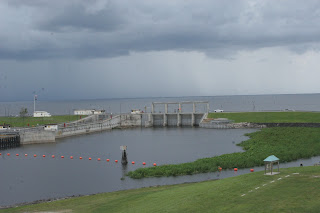
Here the lake seems less wild; there are more buildings and boaters and a man collecting trash from the ramp leading up to the levee. A tractor rests on the inside of the levee on a patch of grass, and a blue heron stares at us. East of our vantage point, a chain link fence separates the heron from a neatly mowed backyard. West of us a barge sits unattended, a colorful sign advertising “ICE SNACKS” in hand-painted lavender letters. White marshmallow clouds over the lake begin to lower themselves and darken.
It’s time to go.
 |
| Storm a-comin' |
On its west side, Okeechobee grows wilder as it seems to spread out. Here we find fewer signs of development, save the odd gas station, house, or government building. Fields of cattle interspersed with cabbage palm line most of the roadway. In Moore Haven, we see a landfill on the lake side of the road, easily the highest point along the route and marked by crows and vultures soaring overhead. Prison inmates help with road construction, holding “STOP” and “SLOW” signs as we chug along the lake’s perimeter. When one of them switches “SLOW” to “STOP” and stop at the front of the line, he pantomimes asking for a cigarette. We shake our heads no and I find myself wondering what one does in this area of Florida to get thrown in jail. The Moore Haven jail offers no more than medium security. It houses fewer than 1,000 inmates, all male.
 |
| This young inmate asked for a smoke. I think the love bug splatter adds a gritty realism here. |
Once we come full circle around the pond, I am still at a loss to describe the lake. Despite severe alteration to the landscape, it feels like a forgotten and untouched part of the state. It also leaves me with an alternating sense of wonder and melancholy. Part of me looks for a way to empathize with the needs filled by businesses and farms whose owners shaped these tragic decisions, but I cannot find it. Part of me is in awe of the lake and the surrounding communities; earning a living here cannot be easy, even for the wealthier: they battle mosquitoes, snakes, gators, and hurricanes with alarming regularity. This part of Florida, despite our attempt to control it, is still frontier. Despite neat rows of sugar cane and peppers and palms, the lake and the sky still rule this corner of the Sunshine State.
Neatly ordered rows of farmland escort the route east until the Loxahatchee area, where subdivisions, strip malls, and golf courses rise up to meet the road until it ends in West Palm Beach at A1A. From Loxahatchee east, the density of the Palm Beach suburbs are a blur after the wide open rolling green of the southernmost interior, and it is almost a culture shock to see farms pushed up against the rows of development. The homes line up along the road in much the same way, just moments ago, sugar cane and tomatoes and peas did.
